
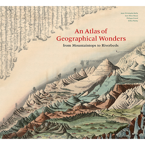
An Atlas of Geographical Wonders
From Mountaintops to Riverbeds
Gilles Palsky, Jean-Marc Besse, Philippe Grand, Jean-Christophe Bailly
- Regular Price
- $50.00
- Sale Price
- $50.00
- Regular Price
- $50.00
- Unit Price
- Translation missing: en.general.accessibility.unit_price_separator
Size: 12 X 11 IN
Pages: 208
Color: 156
Publication Date: 09/24/2019
Rights: World English
ISBN: 9781616898236
This is the first book to catalog comparative maps and tableaux that visualize the heights and lengths of the world's mountains and rivers. Produced predominantly in the nineteenth century, these beautifully rendered maps emerged out of the tide of exploration and scientific developments in measuring techniques. Beginning with the work of explorer Alexander von Humboldt, these historic drawings reveal a world of artistic and imaginative difference. Many of them give way—and with visible joy—to the power of fantasy in a mesmerizing array of realistic and imaginary forms. Most of the maps are from the David Rumsey Historical Map Collection at Stanford University.
Editorial Reviews
The Wall Street Journal
An Atlas of Geographical Wonders: From Mountaintops to Riverbeds catalogs the maps, prints and tableaux that emerged from the work of 19th-century explorers. The images, most of them from the David Rumsey Historical Map Collection at Stanford University, display the era's advances in scientific measuring techniques. At the same time, they also show the artists' pleasure—and sometimes bursts of fantasy—in rendering and imagining the world's mountains and rivers.
The Inquisitive Biologist (UK)
An Atlas of Geographical Wonders is a feast for the eyes, using its layout to good effect to show off the wonderfully reproduced images.
Natural History
The 156 eye-catching tableaux reproduced in this atlas are fascinating variations on a single theme, blending scientific accuracy and graphic inventiveness in fantasy landscapes that convey overarching geographic truths.
The New York Times
Part history, part geography, AN ATLAS OF GEOGRAPHICAL WONDERS: From Mountaintops to Riverbeds illuminates the world of famous 19th-century expeditions. The authors—Jean-Christophe Bailly, Jean-Marc Besse, Philippe Grand and Gilles Palsky—have amassed drawings, maps, graphs and tableaus that trace the adventures of various explorers and show how the science of measuring altitude developed.
Shipping
Orders are processed and shipped within 2–3 business days of receipt. For example, if you place an order on Tuesday, it may not ship until Thursday or Friday.
Ground:
- Est. arrival in 7–10 business days
- $4.99 for all orders up to $39.99.
If your order amount is $40 or more (after any discounts and before tax), your ground shipping is free.
No express shipping is available.
We cannot ship to PO Boxes.
International Shipping
We are a U.S. based publisher and only offer shipping within the United States at this time. For international orders outside of the U.S., our books and products can be found online at your favorite major book retailer. Please see our international distributors page for additional information on where you can purchase our books and products locally.
Return Policy
We do not offer returns. Please contact our customer service team at Hello@chroniclebooks.com if there are any issues with your order.